Wheatland Road Multimodal Corridor Plan
Updated: March 15, 2022
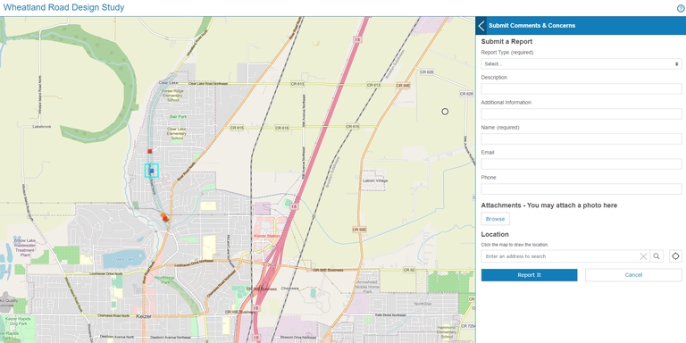
The Wheatland Road Corridor Plan executive study is now available for review. The plan is available here: Wheatland Road Corridor Plan Executive Summary
Current Multimodal Issues on Wheatland Road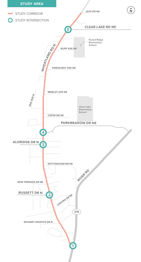
The Wheatland Road study corridor is a 1.8-mile segment from River Road to Jays Drive. Along this corridor, there are many gaps in the sidewalk system, lack of ADA compliant ramps, poor lighting, and bicycle facilities that are not comfortable for riders of all ages and abilities. The primary motor vehicle crash type along the corridor are rear-ends, with a high volume occurring at busier intersections, such as Russett Drive. There is a need for safer pedestrian and bicycle crossings of Wheatland Road with two elementary schools in the area and many school bus and transit stops along the study corridor. The Wheatland Road Multimodal Corridor Plan aims to create a conceptual street design that:
- Removes barriers and creates a balanced multimodal transportation system
- Connects neighborhoods with Clearlake Elementary and Forest Ridge Elementary schools
- Improves safety for all modes of travel
- Develops community understanding and support for the plan
Project Documents & Reports
To find out more about the project, read the existing reports here:
- Wheatland Road Existing and Future Forecast Conditions
- Wheatland Road Evaluation Criteria
- Wheatland Road Design Alternatives and Tier 1 Screening
- Wheatland Road Corridor Plan Executive Summary
Study Area
Project Process & Timeline
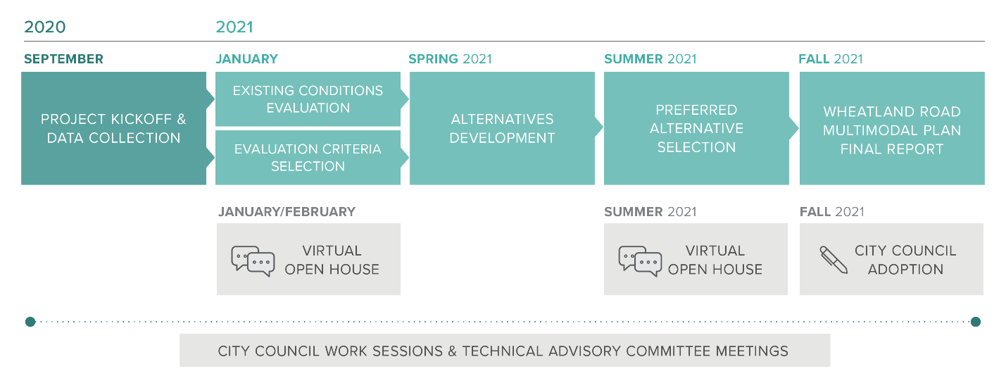
The corridor study project started in September 2020 and will be complete in Fall of 2021. Two virtual open house events will be held, at which the public is encouraged to provide feedback on the project and voice the needs of community. The first Virtual Open House was held from February 12th - March 21st, 2021 and the second Virtual Open House will be held from July 23rd - August 8th, 2021.
How is the Plan Being Funded?
The Wheatland Road Multimodal Corridor Plan is funded using a federal transportation grant supplied by the Salem Keizer Area Transportation Study (SKATS), which is the designated Metropolitan Planning Organization for the Salem-Keizer-Turner area. For the study, $191,000 in federal funds are being used, with a local match of $21,861 from the City of Keizer.
Contact
If you have any questions or comments about the project, please reach out to the contacts below:
Bill Lawyer – City of Keizer, Public Works DirectorPhone: (503) 390-3700 Email: LawyerB@keizer.org
Scott Mansur – DKS Associates, Transportation EngineerPhone: (503) 391-8773 Email: scott.mansur@dksassociates.com